Mapping: Illuminate, Optimize, Transform
Unlock Insights, Optimize Decisions, Transform the world -- with Geospatial Maps.
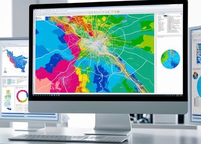

Visualizing Data through Maps
Transform data into actionable geospatial insights: MGeoS can do that for you. Grounded in advanced academic training and practical experience, MGeoS manages large datasets to produce high-quality, decision supporting maps that help you understand the problem and see the solution.
Geospatial Software Experience
MGeoS has experience in geospatial software such as ArcGIS Pro, QGIS, Global Mapper and PCE Geomatica, and can work with LiDAR, multispectral, hyperspectral, Spectral Aperture Radar (SAR) and aerial imagery in diverse applications.


Fusing Data
Remote sensing; Digital image processing; Photogrammetry: MGeoS can fuse geospatial and non-geospatial data, then apply machine learning to illuminate the problem and point you toward the solution.
Click here for a more comprehensive list of MGeoS services.
Visualization Outputs: SEE the Solutions
Creating impactful visual representations of complex geospatial data will give you clarity on both problems and solutions. MGeoS will transform spatial data into clear, engaging visuals that reveal patterns and relationships. Techniques like 3D mapping, heatmaps and interactive layers will enhance your data exploration and support your decision-making in fields such as urban planning, environmental management and disaster response.
McBean Geospatial Solutions
Mapping the Future, One Solution at a Time
Feel free to use the form below or email: mcbean.geospatial.solutions at gmail dot com
© 2025. All rights reserved.